Campus News
February 8th, 2024
Nichols tells the story of Garrett County via maps
Interesting cartographic facts and history shared in JCLS presentation

Photo by John Rudd
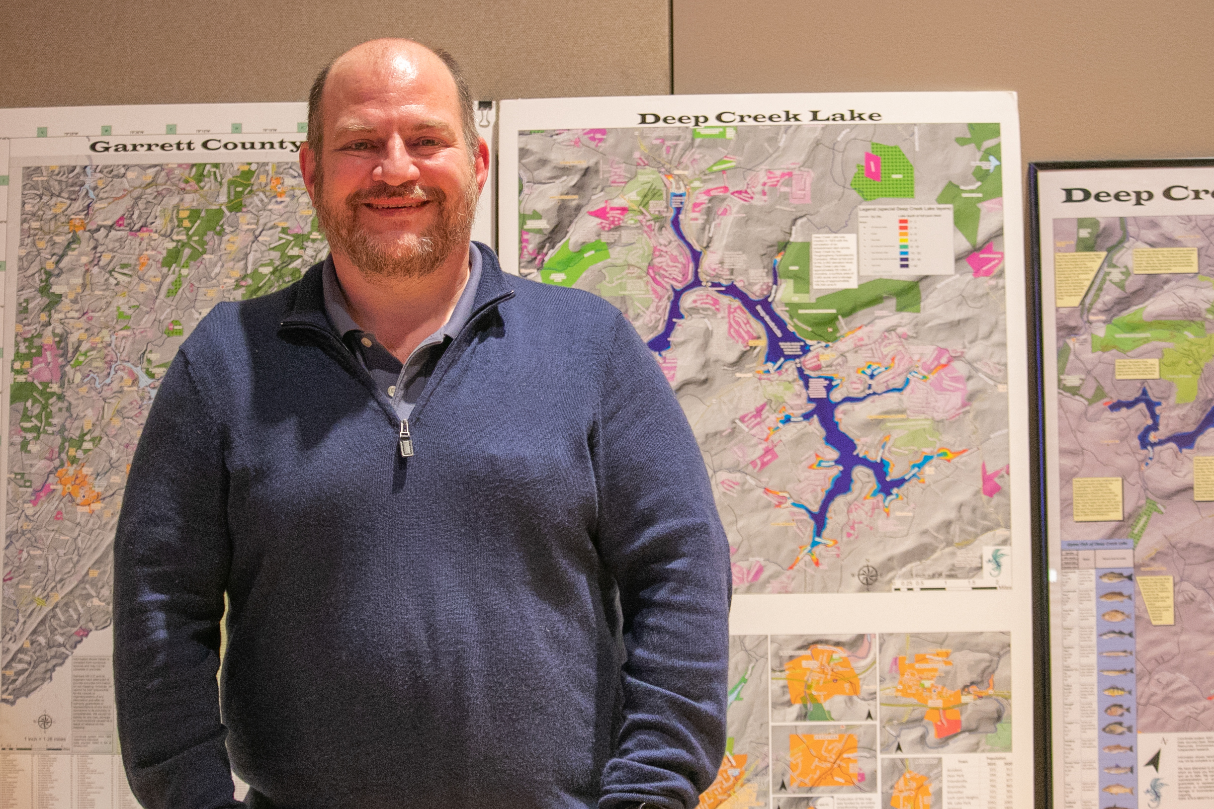
Chris Nichols used maps to explore Garrett County's history last Wednesday night during his Joan Crawford Lecture Series presentation at Garett College.
Terra Alta . . . Maryland? That might just be true had it not been for a mapping decision, according to Chris Nichols.
Nichols, lecturing last Wednesday night in the Performing Arts Center at Garrett College, said surveyors were brought in to settle an 18th-century dispute over the Maryland-Virginia border.
"The surveyors picked the North Branch of the Potomac [River] as the border rather than the south branch," explained Nichols. "Otherwise, territory between those branches . . . could have ended up part of Garrett County."
That was one of many interesting cartographic tidbits Nichols included in his Joan Crawford Lecture Series (JCLS) presentation, entitled History of Garrett College in Maps. Nichols included information on creation of the C & O Canal, Meshach Browning's (somewhat embellished) hunting exploits, evolutions in Garrett County industries, and the gradual growth around Deep Creek Lake as it became more easily accessible – all supported by various types of maps.
Nichols, an energy markets analyst with the National Energy Technology Laboratory in Morgantown, started in the beginning – about 300 million years ago during the Carboniferous Period. He quickly moved a lot closer to present times, with information about the early inhabitants of what became Garrett County.
"This land was originally settled and used by Indigenous People before they were pushed out by a relentless expansion to the west," said Nichols. "Their settlements weren't long-range or permanent, but they built hunting camps that were seasonal and permitted them to raise certain crops."
The 18th- and 19th-century westward movements didn't result in large settlements in present-day Garrett County due to conditions illustrated by several Nichols maps.
"Using a topographical map of the county, you can see we're on a mountaintop plateau running northeast to southwest," said Nichols. "That created some interesting things as far as our weather goes – a lot of precipitation, and relatively cooler temperatures than surrounding areas.
"The ruggedness of the area created an isolated environment," added Nichols.
It was through no lack of effort that present-day Garrett County remained isolated well into the 19th century.
"To pay their revolutionary soldiers, the Maryland General Assembly passed an act in 1777 to compensate soldiers with 40 dollars, a pair of shoes, a pair of stockings, and 50 acres of land," Nichols told the standing-room-only audience. "The State sent a surveyor to chop up the western area of the state into those 50-acre lots.
"The land grants to revolutionary war veterans didn't grow western Maryland's population," added Nichols. "Most of them sold off the lands to prospectors."
Nichols said Garrett County began to grow dramatically after the B & O Railroad came through the county in the 1870s.
"Railroads created accessibility to the county," said Nichols. "The railroad led to the development of Oakland, Mountain Lake Park, Deer Park, and other towns along the route.
"Every town developed their own personality," continued Nichols. "Many built hotels along the railroad – these hotels were really grand structures."
Nichols also shared maps from the 1880s through the early 1900s showing the industries of that time period.
"Industry was limited mainly to things that you could grow and things that you could dig," said Nichols, including maple sugar, buckwheat, Irish potatoes, dairying, cattle-feeding, coal, and lime.
Nichols using a series of maps focused on Deep Creek Lake and its surroundings – from the 1940s, '70s, '80s, and 2010s – to show how and where population growth took place.
"These maps show the population growth in areas around the lake," said Nichols. "Those spots really started filling in after the opening of I-68 in the 1990s.
Energy maps showed the transition from coal and natural gas to hydro, solar, and wind plants.
"The ridge lines create good resources for wind," observed Nichols.
Notes: Nichols' presentation is available at www.dimesy.com.
Garrett College's faculty created the Joan Crawford Lecture Series in honor of the dynamic educator Joan R. Crawford.
Crawford, who died in 2010, served the College community for more than 30 years, including serving as the head of the humanities division and director of enrollment. After her retirement, Crawford was named Professor Emerita.
The Joan Crawford Lecture Series of presentations are offered free of charge, and the public and community members are invited to attend.
All presentations from the Joan Crawford Lecture Series will be available to view online through the College's Facebook page. The lectures will be live streamed and recordings will be posted shortly after the event.
For more information, contact Stephanie Miller at stephanie.miller@garrettcollege.edu.


